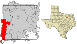
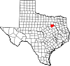
Grand Prairie, Texas
| City of Grand Prairie | |
|---|---|
| — City — | |
 |
|
| Nickname(s): GP | |
 |
|
| Coordinates: | |
| Country | |
| State | |
| Counties | Dallas, Tarrant, Ellis |
| Government | |
| - Type | Council-Manager |
| - City Council | Mayor Charles England Richard Fregoe Mark Hepworth Ruthe Jackson Ron Jensen Greg Giessner Tony Shotwell Jim Swafford Bill Thorn |
| - City Manager | Tom Hart |
| Area | |
| - Total | 81.5 sq mi (211.2 km2) |
| - Land | 71.4 sq mi (184.9 km2) |
| - Water | 10.1 sq mi (26.3 km2) |
| Elevation | 515 ft (157 m) |
| Population (2006) | |
| - Total | 153,812 |
| - Density | 2,154.2/sq mi (831.9/km2) |
| Time zone | CST (UTC-6) |
| - Summer (DST) | CDT (UTC-5) |
| ZIP codes | 75050-75054 |
| Area code(s) | 972, 214, 469 |
| FIPS code | 48-30464[1] |
| GNIS feature ID | 1336802[2] |
| Website | www.gptx.org |
Grand Prairie is a city in Dallas, Ellis, and Tarrant Counties in the U.S. state of Texas and is a part of the Mid-Cities region in the Dallas-Fort Worth Metroplex. Grand Prairie is a suburb of both Dallas and Fort Worth and in 2006 had a population of 153,812.
Contents |
History
The city of Grand Prairie was first established as “Dechman” by Alexander McRae Dechman in 1863. Dechman, who was from Birdville learned that he could trade his oxen and wagons for land in Dallas County. In 1863, Dechman bought 239 ½ acres of land on the eastern side of the Trinity River and 100 acres (.40 km2) of timber land on the west side of the river for a broken down wagon, oxen team and US$200 in Confederate money. He tried to establish a home on the property, but ran into difficulties, so he returned to his family in Birdville before joining in the Civil War. Then in 1867, he filed a town plat consisting of 50 acres (200,000 m2) with Dallas County.
After the war, he returned to Birdville for two years before selling that farm in 1867 and moving to Houston, where Yellow Fever broke out causing the family to settle in Bryan. In 1876, Dechman traded half his "prairie" property to T&P Railroad to ensure the railroad came through the town. The railroad named the depot "Dechman" prompting its namesake to relocate his home from Bryan to Dechman. His son Alexander had been living in Dechman and operating a trading post and farm. The first church in the area was the Good Hope Cumberland Sabbath School established in 1870 by Rev. Andrew Hayter. The church was later renamed West Fork United Presbyterian Church and remains an active church.[3]
The first U.S. Post Office opened in 1877 under the name “Deckman” rather than "Dechman" because the United States Postal Service couldn't read the writing on the form completed to open the post office. Later that same year, after the Postal Service had adopted the "Deckman" name, confusion resulted from the T&P Raiload designation Grand Prairie. This name was based on maps drawn from around 1850 through 1858 that labeled the area between Dallas and Fort Worth "the grand prairie of Texas". In order to alleviate the confusion, the Postal Service named the post office Grand Prairie.
The town of Grand Prairie was eventually was incorporated as a city in 1909. During World War II and since, Grand Prairie has had a long history with the defense and aviation industry. While the present day Vought plant on Jefferson Ave. is part of a small strip of the Dallas city line; it was originally in Grand Prairie. During WWII it was a North American Aviation plant that produced the P-51C and K Mustang variants. After the war, Vought Aircraft took over the plant. This later became Ling Temco Vought and then eventually returned to the Vought moniker. The plant was the production site for the F-8 Crusader and the A-7 Corsair II aircraft of the 1950-1989 time period. The Missile and Space division of LTV produced missiles such as the Scout and MLRS. This division was eventually sold to Lockheed Martin which continues to operate in Grand Prairie. Grand Prairie was also the North American headquarters for Aérospatiale Helicopter. This company eventually became American Eurocopter a division of EADS North America.
Geography
Grand Prairie is located at (32.715266, -97.016864).[4]
According to the United States Census Bureau, the city has a total area of 81.5 square miles (211.2 km²), of which, 71.4 square miles (184.9 km²) of it is land and 10.1 square miles (26.3 km²) of it (12.44%) is liquid.
The West Fork of the Trinity River and a major tributary, Johnson Creek, flow through Grand Prairie.
Grand Prairie has a long history of flooding from Johnson Creek. In the 1980s a major Army Corps of Engineer project was started to straighten the channel which has reduced the damage of flooding.
Demographics
As of the census[1] of 2000, there were 127,427 people, 43,791 households, and 32,317 families residing in the city. The population density was 1,784.6 people per square mile (689.1/km²). There were 46,425 housing units at an average density of 650.2/sq mi (251.0/km²). The racial makeup of the city was 62% White, 13.5% African American, 0.8% Native American, 4.42% Asian, 0.1% Pacific Islander, 15.90% from other races, and 3.34% from two or more races. Hispanic or Latino of any race were 33% of the population.
There were 43,791 households out of which 41.3% had children under the age of 18 living with them, 54.9% were married couples living together, 13.7% had a female householder with no husband present, and 26.2% were non-families. 20.7% of all households were made up of individuals and 4.5% had someone living alone who was 65 years of age or older. The average household size was 2.90 and the average family size was 3.38.
In the city the population was spread out with 30.5% under the age of 18, 10.1% from 18 to 24, 34.1% from 25 to 44, 18.8% from 45 to 64, and 6.4% who were 65 years of age or older. The median age was 30 years. For every 100 females there were 98.0 males. For every 100 females age 18 and over, there were 95.2 males.
The median income for a household in the city was $46,816, and the median income for a family was $51,449. Males had a median income of $35,300 versus $28,184 for females. The per capita income for the city was $18,978. About 8.7% of families and 11.1% of the population were below the poverty line, including 15.2% of those under age 18 and 10.4% of those age 65 or over.
Government
Local government
According to the city’s most recent Comprehensive Annual Financial Report, the city’s various funds had $275.5.million in Revenues, $236.4 million in expenditures, $1,003.2 million in total assets, $424.9 million in total liabilities, and $305.9 million in cash and investments.[5]
The structure of the management and coordination of city services is:[5]
| City Department | Director |
|---|---|
| City Manager | Tom Hart |
| Airport Director | Randy Byers |
| Court Services Director | Steven Cherry |
| Budget Director | Kathleen Mercer |
| Director of Planning and Development | Bill Crolley |
| Environmental Services Director | Jim Cummings |
| City Secretary | Cathy DiMaggio |
| Parks & Recreation Director | Rick Herold |
| Police Chief | Glen Hill |
| Housing & Neighborhood Services Director | Bill Hills |
| Public Works Director | Ron McCuller |
| Fire Chief | Clif Nelson |
| Human Resources Director | Lisa Norris |
| Chief Financial Officer | Diana Ortiz |
| Economic Development & Information Technology Director | Bob O’Neal |
| City Attorney | Don Postell |
| Library Director | Kathy Ritterhouse |
| Transportation Director | Jim Sparks |
| Marketing Director | Amy Sprinkles |
| Management Services Director | Cathy Patrick |
Federal representation
The Federal Bureau of Prisons (BOP) has the Grand Prairie Office Complex on the grounds of the U.S. Armed Forces Reserve Complex.[6] Within the complex the BOP operates the Designation and Sentence Computation Center (DSCC), which calculates federal sentences, keeps track of the statutory "good time" accumulated by inmates and lump sum extra "good time" awards, and detainers. [7]
Economy
According to the City's 2008 Comprehensive Annual Financial Report,[5] the top employers in the city are:
| # | Employer | # of Employees |
|---|---|---|
| 1 | Grand Prairie Independent School District | 3,200 |
| 2 | Lockheed Martin Missiles and Fire Control | 2,600 |
| 3 | Poly-America, Inc. | 1,400 |
| 4 | Bell Helicopter-Textron | 1,300 |
| 5 | Lone Star Park at Grand Prairie | 1,200 |
| 6 | City of Grand Prairie | 1,200 |
| 7 | Vought Aircraft Industries | 700 |
| 8 | Siemens Energy & Automation, Inc. | 600 |
| 9 | Hanson Pipe & Products | 500 |
| 10 | Wal-Mart | 500 |
Six Flags maintains a corporate office in Grand Prairie.[8]
In 1978 American Airlines announced that it would move its headquarters from New York City to the Dallas/Fort Worth area.[9] American Airlines moved its headquarters into two leased office buildings in Grand Prairie. The airline finished moving into its Fort Worth, Texas headquarters facility on January 17, 1983, when the airline left its Grand Prairie facility.[9]
Education
Primary and secondary schools
Public schools
Most of Grand Prairie's K-12 student population attends schools in the Grand Prairie Independent School District, which serves areas of Grand Prairie in the Dallas County. The Mansfield Independent School District serves areas of Grand Prairie in Tarrant County and operates six elementary schools within the Grand Prairie city limits. Other portions of Grand Prairie reside within the Arlington, Cedar Hill, Irving, Mansfield, and Midlothian school districts.[10]
In Texas, school district boundaries do not always follow city and county boundaries because all aspects of the school district government apparatus, including school district boundaries, are separated from the city and county government.
Grand Prairie Independent School District
The high schools in the district are Grand Prairie High School, South Grand Prairie High School, Crosswinds High School and Dubiski Career High School.
Arlington Independent School District
The Arlington ISD has the second highest portion of Grand Prairie's K-12 student population. Six Arlington ISD elementary schools are within the city limits of Grand Prairie. Grand Prairie residents in the Arlington ISD are located generally west of the Dallas-Tarrant County boundary and north of the intersection of Camp Wisdom and Lake Ridge in southwest Grand Prairie. One of the Arlington high schools, James Bowie High, has more Grand Prairie residents than Arlington residents that are students at the school.
Grand Prairie student/residents in the Arlington ISD will attend Bowie, Sam Houston, or Lamar High School in the Arlington ISD and their feeder elementary schools and junior high schools.
Mansfield Independent School District
The Mansfield ISD contains the third highest portion of the Grand Prairie's K-12 student population. Grand Prairie residents in the Mansfield ISD are located generally south of the intersection of Camp Wisdom and Lake Ridge, and west of Joe Pool Lake to the Tarrant and Ellis County line in southwest Grand Prairie. No Mansfield ISD schools are currently open within the city limits of Grand Prairie, but two elementary schools and one junior high school are planned to be built in these areas. The Mansfield ISD is the fastest growing ISD in Tarrant County, and the population growth in far southwest Grand Prairie is a major factor in the Mansfield ISD's subsequent growth.
Grand Prairie students/residents in the Mansfield ISD will attend Mansfield Timberview High School or Mansfield High School in the Mansfield ISD or their feeder elemetaries and junior highs. Timberview High School is located on State Highway 360 less than 100 yards (91 m) from the Grand Prairie city line.
Infrastructure
Transportation

Interstate highways 20 and 30 run east-west through the city, along with SH 303, SH 180, and SH 161, a future extension of the Dallas outerloop (President George Bush Turnpike). FM 1382 (Belt Line Road) begins from SH 180, crossing I-20 and eventually heading to Cedar Hill.
There is presently no public transportation in Grand Prairie, as the city is not a member of Dallas Area Rapid Transit.
Attractions
- In 1997 Lone Star Park was opened, where each Memorial Day is held the Thoroughbred meeting with seven stakes races worth just over $1 million.
- In 2000 GPX Skate Park, was opened up next to Lone Star Park, which hosted the 2001 and 2002 X-Games trials. They closed in 2005 and were later re-opened in June 2006 by the Grand Prairie Parks and Recreation committee.
- The state of the art Verizon Theater at Grand Prairie, previously NextStage, is in Grand Prairie. Numerous concerts and other events are held here throughout the year.
- Prairie Lights, a two-mile (3 km) long seasonal display, featuring more than three million lights on more than 500 lighted displays. Santa’s elves, snowmen, reindeer, angels, penguins, stars, lollipops and the world’s longest tunnel of lights are just a few of the displays showcased during the 40-day event. The theme park also offers a unique out-of-car experience in Holiday Village mid-way through the drive with concessions, carousel rides, Santa’s Store for shopping and photos with Santa on Fri., Sat. and Sun. A new attraction in 2007 was Holiday Magic by John Barrett’s Lightasmic and sponsored by Chesapeake Energy which offered a 10-minute walk through choreographed light show. Dates for 2007 were from November 22 to December 31.
- In 1973 Traders Village was opened off of State Highway 360 and it boasts as the largest Flea Market in Texas where it opens on weekends from 8 A.M. until Dusk. There is also special events held at Traders Village on certain weekends. Those events include Chili Cookoff, auto swap-meet, etc.
- The AirHogs minor league baseball team and their stadium, Quiktrip Park were established in Grand Prairie in May 2007 and started play in May 2008.
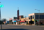
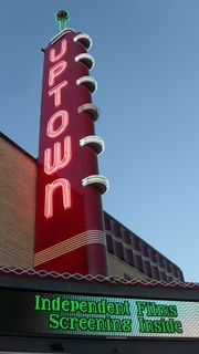
- The historic Uptown Theatre in Downtown Grand Prairie is opened after a year of renovations.
Notable natives
- Selena Gomez - actress, singer
- Charley Taylor - professional football player
- Ren Vokes - America's Next Top Model contestant
Notable residents
- Bob Lagree (better known as Captain Safety) - professional wrestler featured in Ripley's Believe It Or Not
- Larry Dell Alexander, Artist/Writer
References
- ↑ 1.0 1.1 "American FactFinder". United States Census Bureau. http://factfinder.census.gov. Retrieved 2008-01-31.
- ↑ "US Board on Geographic Names". United States Geological Survey. 2007-10-25. http://geonames.usgs.gov. Retrieved 2008-01-31.
- ↑ Texas State Historical Marker 5760
- ↑ "US Gazetteer files: 2000 and 1990". United States Census Bureau. 2005-05-03. http://www.census.gov/geo/www/gazetteer/gazette.html. Retrieved 2008-01-31.
- ↑ 5.0 5.1 5.2 City of Grand Prairie CAFR Retrieved 2009-07-16
- ↑ "Grand Prairie Office Complex." Federal Bureau of Prisons. Retrieved on January 9, 2010.
- ↑ Zych, C. "Admission and Orientation Handbook Federal Correctional Institution Milan, Michigan." Federal Bureau of Prisons. 6 (8 of 24). Retrieved on May 8, 2010.
- ↑ "Contact Us." Six Flags. Retrieved on May 6, 2009.
- ↑ 9.0 9.1 "American Airlines Finishes Moving into Headquarters Monday." Associated Press at Ocala Star-Banner. January 16, 1983. 6A. Google News 4 of 62. Retrieved on August 27, 2009.
- ↑ "Greetings from Grand Prairie." City of Grand Prairie. Retrieved on December 27, 2008.
External links
- City of Grand Prairie (official website)
|
||||||||||||||||||||

|
||||||||||||||||||||
|
||||||||||||||||||||
|
|||||||||||||||||
|
|||||||||||||||||
|
|||||||||||||